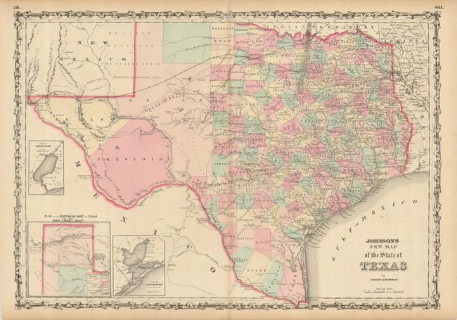
Subject: Texas
Period: 1860 (circa)
Publication:
Color: Hand Color
Size:
24.3 x 17 inches
61.7 x 43.2 cm
The first edition of this handsome map, with county development mostly in eastern Texas and only the three large counties of El Paso, Presidio, and Bexar in the west. The panhandle, noted as the Staked Plain (Elevated Table Land, without Wood or Water), includes a large section that is unorganized. There are numerous wagon roads, a fe wcompleted railroads, and the US Mail Route. Insets include a Plan of Sabine Lake, Plan of the Northern part of Texas, and Plan of Galveston Bay. Surrounded by Johnson's early strapwork border. Blank on verso.
References:
Condition: B
A sound example with original color. The centerfold has been repaired on the verso with tissue, with a small amount of tissue on the face of the map at the upper border. There are some minor scattered abrasions caused by erasure of old pencil marks.