Catalog Archive
Auction 123, Lot 286

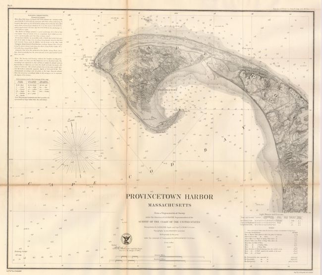
"Provincetown Harbor, Massachusetts", U.S. Coast Survey

Subject: Massachusetts

Period: 1857 (dated)

Publication:

Color: Black & White

Size:
17.3 x 14.6 inches
43.9 x 37.1 cm
Download High Resolution Image
(or just click on image to launch the Zoom viewer)

Wonderful sea chart showing the tip of Cape Cod with soundings, sailing directions and the approach to anchor at Provincetown. The sailing directions describe navigational hazards and there is a table beneath with a chart of the types of sea bottom materials. An inset locates lighthouses and gives the heights of tides during the various times of year. Provincetown is well shown, with the city hall noted.

References:

Condition: B

Some toning along the folds as is the norm for maps of this type. The folds have some separations that have been repaired on the verso with archival tape.

Estimate: $100 - $140

Sold for: $120

Closed on 2/20/2008

Archived