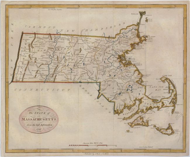
Subject: Massachusetts
Period: 1796 (dated)
Publication: The American Atlas
Color: Hand Color
Size:
18 x 14.8 inches
45.7 x 37.6 cm
A rare early map of the coast showing excellent detail from Piscataqua Harbor in Portsmouth south to Boston Harbor and Cape Cod. The map shows roads across the state and notes many towns and cities. An early survey marker, Station Trees, is located just north of Dracut at the New Hampshire border with two tiny trees engraved at that point. This map was based on Carey's map of 1795 and it is from the second atlas printed in America. It is rarely seen on the market.
References: Wheat & Brun #219.
Condition: B+
An attractive map issued folding, now flattened with fold intersections reinforced with tissue on the verso. The left margin has some paper added to the binding trim to better accommodate framing. It has some faint offsetting, else fine.