Subject: Hawaii
Period: 1903 (dated)
Publication:
Color: Printed Color
Size:
34 x 24 inches
86.4 x 61 cm
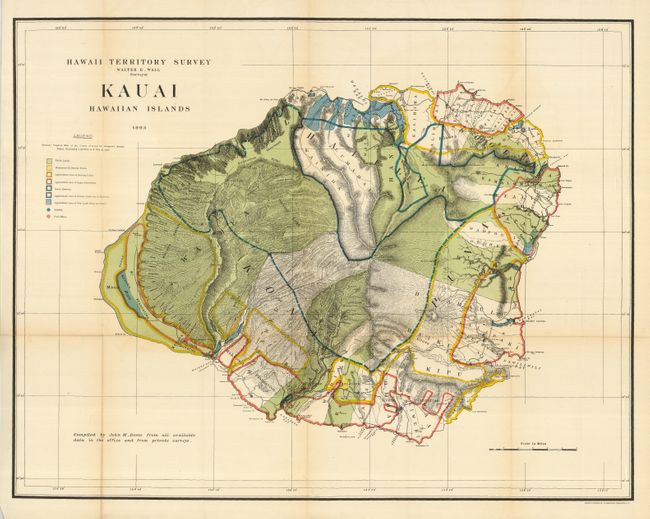
Brilliantly colored and detailed map of Kauai with information on pineapple and sugar plantations, homesteads, public lands, swampland and unsurveyed areas. This very attractive example delineates public and private family holdings as well as rice fields, sugar plantations, roads, schools, forts and the location of a wireless telegraph pole. Hawaii's monarchy was overthrown in 1893, and this map was prepared for the Governor's Annual Report of 1906. The governor at this time was George R. Carter. Compiled by John M. Donn "from all available data in the office and from private surveys."
References:
Condition: B+
Very nice example with a little toning, much less than normally seen on this map. Issued folding, this example is backed with archival tissue. Fine, strong coloring and original margins.