Subject: North Dakota
Period: 1878 (published)
Publication:
Color: Black & White
Size:
21.3 x 15.5 inches
54.1 x 39.4 cm
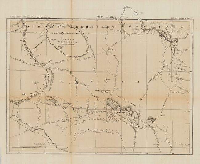
This map is number five from a series of six maps and one profile view printed by the United States Northern Boundary Commission. The maps were part of the process of separating out the territories of Montana, Dakota and Minnesota from each other and Canada. The boundaries were marked with mounds and iron pillars that were spaced one mile apart. This map shows trails reconnoitered by parties of the Boundary Commission, as well as wagon roads, forts and Indian reservations. Among the routes marked are those of Capt. W.J. Twining (1869/1873), Lt. F.V. Greene (1873/74), C.L. Doolittle (1874) and the Half Breed Road to Woody Mountain. This map is roughly centered on Devil's Lake and shows a bit of the Couteau du Missouri and portions of the James and Cheyenne Rivers. Many interesting features located including Turtle Mountain and Ft. Totten.
References:
Condition: B+
A good example with some light fold toning and two minor fold intersection splits, else very good.