Subject: United States - Southwestern
Period: 1871 (dated)
Publication: Lloyd's Atlas of the United States
Color: Hand Color
Size:
27.5 x 16.5 inches
69.9 x 41.9 cm
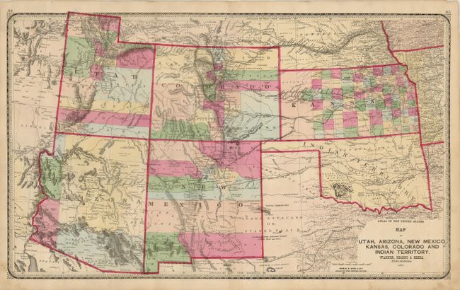
This large double-page map of the Southwest from this uncommon atlas shows early county development with good detail of railroads, wagon roads, forts and emerging cities. Arizona features its first four counties - Yavapai, Yuma, Mohave and Pima. It also shows the short-lived county of Pah-Ute along the northwest border; a political artifact resulting from Arizona's loss of its northwestern corner to Nevada. Terrific detail identifies U.S. Mail routes, telegraph routes, Hastings Road, the Santa Fe and Fort Smith Road, and much more. Enclosed in a decorative border with handsome Victorian-style titling.
References: Blevins Mapping Wyoming #354.
Condition: B+
Crisp, dark impression with fine, bold original color. Some minor foxing mostly confined to the margins. Centerfold separation (1/2") in margin repaired with paper tape on verso.