Subject: Washington and Idaho
Period: 1858 (dated)
Publication: Report of the Construction of a Military Road …
Color: Hand Color
Size:
20.5 x 21.8 inches
52.1 x 55.4 cm
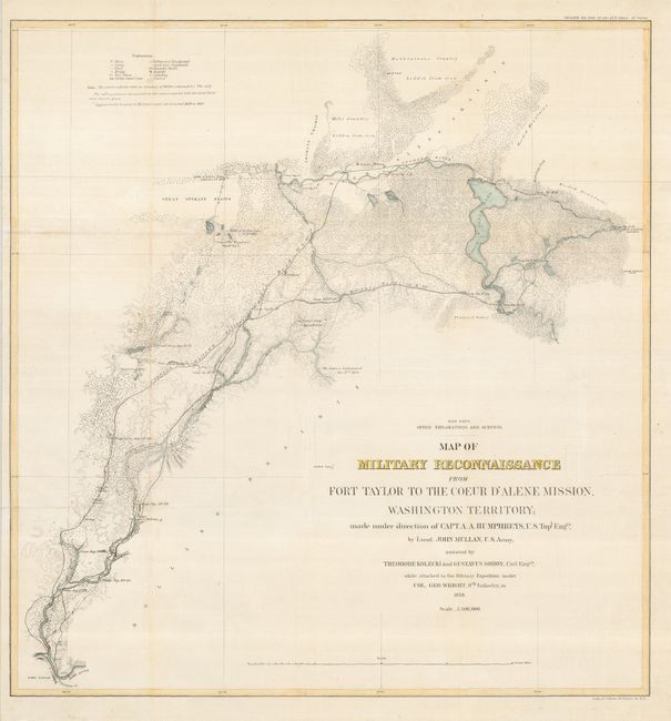
This map shows detail of the military wagon road from Fort Taylor to the Coeur d'Alene Mission, and presents the topography with an amazing amount of information. This is the second, in a set of three, sectional maps that detail the reconnaissance led by Lieut. John Mullan that resulted in the Mullan Trail. According to Wheat, this was the most famous road ever constructed in the high Northwest. Originally built as a military road, it became an important emigrant route and the major route into the gold regions of Idaho and Montana. The map shows the expedition camps and locations of battles fought with the Indians during the survey. It is one of the earliest maps to show in detail the region that would become Spokane, WA and Coeur d'Alene in the Idaho panhandle. The farm and ferry of Antoine Plante is depicted. Plante, a French Canadian who came overland with the Astor party, settled in Spokane Valley near what is now the town of Millwood in 1849. In 1861 he received authorization to build the first ferry across the Spokane River. The map was published in 1863.
References: Wheat (TMW) #1078.
Condition: B+
Issued folding, now flattened and backed with Japanese tissue to repair some fold separations that are so common in maps of this sort. There are a couple of light damp stains.