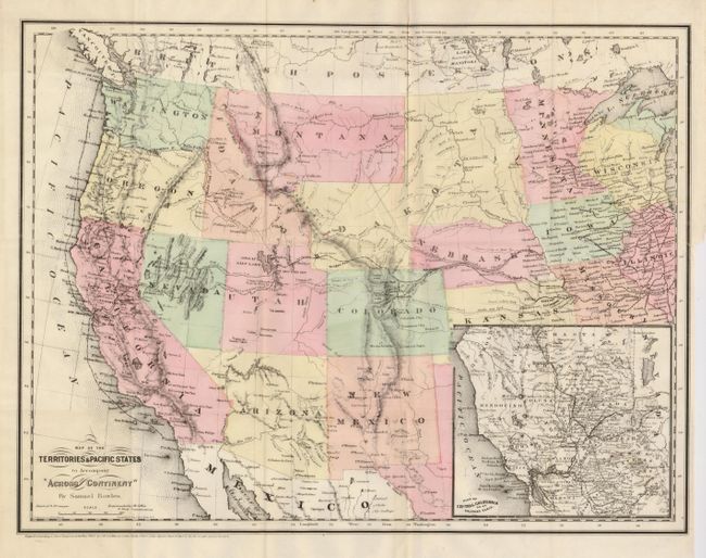
Subject: Western United States
Period: 1865 (dated)
Publication: Across the Continent
Color: Hand Color
Size:
18 x 13.8 inches
45.7 x 35.1 cm
A handsome map of the western U.S. showing the routes of the Union Pacific and Central Pacific railroads, the Butterfield Express and Stage route, mail routes and the tracks of the Colfax expedition. The Spanish Trail and Emigrant Road are also featured on this very detailed map that was engraved by Goldthwaite and printed by Colton on banknote paper. The map shows a large Dakota Territory that includes today's Wyoming. Arizona still in possession of the southern tip of Nevada. A large inset titled Plan of Central California on an Enlarged Scale shows excellent detail of the San Francisco area and the gold regions.
References: Blevins Mapping Wyoming #183.
Condition: B+
A binding tear reaching into the map has been repaired with framer's tape on verso. A tiny pinhole at one fold intersection. Otherwise an excellent example.