Subject: Central United States
Period: 1887 (dated)
Publication:
Color: Hand Color
Size:
21.4 x 14 inches
54.4 x 35.6 cm
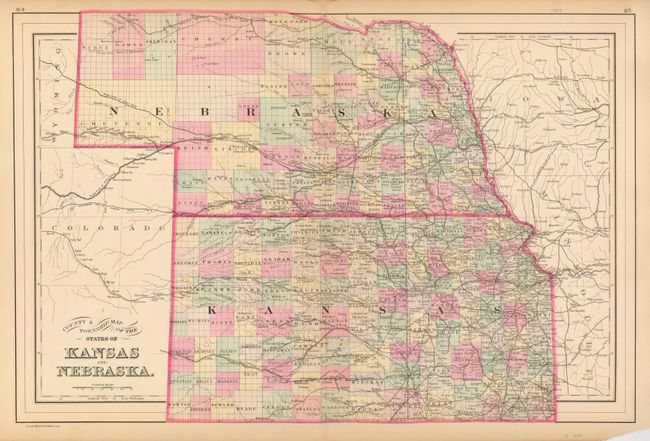
Very handsome double page map showing the fast moving westward expansion of settlements. In this uncommon map, the western third of Kansas and most of Nebraska are still largely unsettled even though counties have been established. The map is after Mitchell, from the Philadelphia publishing firm of William M. Bradley & Bros. The map is finely engraved and shows good detail of the watershed, in addition to railroads, towns, cities, forts, etc.
References:
Condition: B+
Better original coloring than often seen on Bradley's maps. Short centerfold splits at top and bottom. Both just to edge of map and well closed on verso with archival tape. A small bit of marginal loss at lower right corner due to folding.