Subject: Western Hemisphere
Period: 1777 (dated)
Publication:
Color: Hand Color
Size:
25.3 x 19.5 inches
64.3 x 49.5 cm
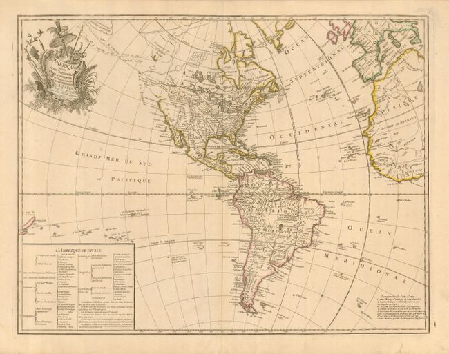
This fascinating map illustrates some of the most interesting mythical cartography juxtaposed with important new discoveries in North America. The routes of Delisle and Tchirikow are shown in 1741 terminating on a vague island in the approximate location of Alaska. A Northwest Passage (shown by lightly engraved lines) links the Pacific with Hudson Bay where there is a note concerning the British discoveries of 1742. The Riv. de l' Ouest stretches from Lake Superior nearly to the Pacific, based on the reports of the Jesuit missionary, Pierre de Charlevoix. In South America the Amazon River is detailed according to Condamine's expedition. A text table lists the colonial possessions. This is a later issue of a map first published in 1746, with La Rouge's imprint and date printed separately.
References:
Condition: A
A very good impression on a strong sheet with original outline color. There is a short tear in the lower margin that just enters the border, now repaired on the verso with paper.