Subject: Western Hemisphere
Period: 1792 (dated)
Publication:
Color: Hand Color
Size:
17.5 x 14 inches
44.5 x 35.6 cm
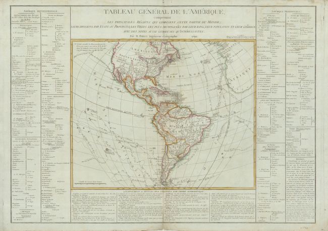
This large map of the Americas provides a detailed view of the colonial possessions and the most recent explorations. The new United States is shown with its boundary on the Mississippi River. Both Florida and Louisiana are shown under Spanish control. The Northwest coast of North America is labeled Decouvertes des Russes and is largely blank in the interior. Numerous exploration routes are charted including those of Cook, Bougainville, and Biron and the Spanish Manila to Acapulco route is shown. The map is surrounded on three sides with panels of French text on a sheet measuring 28.5 x 20.3".
References:
Condition: B
On a sheet of faintly blue French paper with the center reinforced on the verso, and a repaired tear into the text at top right. The map has a little color offsetting, a couple repaired wormholes and a little toning on the centerfold.