Subject: Exploration and Surveys, Western United States
Period: 1863 (published)
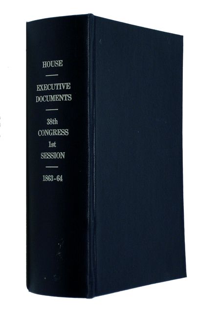
Publication: Ex. Docs. 38th Cong. 1st Sess.
Color: Black & White
Size:
6 x 9 inches
15.2 x 22.9 cm
This report accompanied the Message of the President of the United States, and Accompanying Documents to the Two Houses of Congress, at the Commencement of the First Session of the Thirty-eighth Congress, and includes 9 foldout maps bound in at the back. The nicely engraved maps show early surveying and the lands of the various tribes inhabiting the West in excellent detail. The report focuses on the "management" of the more powerful Indian tribes such as the Navajoes and Apaches of Arizona and New Mexico, as well as the larger tribes in the interior lands. The Secretary's report describes the difficult conditions the Indians are enduring, mainly disease and hunger, and advises the President on a better organized system of medical supply distribution, and on preparing for the designation of additional reservation lands.
The maps are listed as follows:
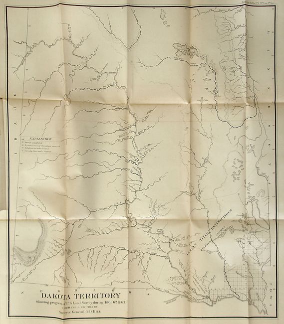
Dakota Territory. This is a very early map of Dakota Territory showing a survey grid cluster in only the southeastern corner. The region just west of the surveyed land is noted as Indian Title Extinguished Yankton Cession with a 400,000 acre Yankton Reserve located across the Missouri River from Ft. Rendall. Close by, the Ponka Reserve lies between the Niobrara and Ponka Rivers. The balance of the chart is largely blank with only detail of the rivers and some topography and the locations of a few forts and Indian villages along the Missouri River.
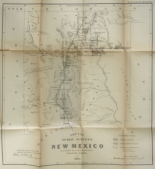
Sketch of Public Surveys in New Mexico. Early map showing the newly truncated territory following the creation of Arizona Territory. Survey progress is limited to regions along the Rio Grande River and between Albuquerque and Las Vegas. Locates private and Pueblo Indian grants surveyed, as well as numerous forts, copper mines near Santa Rita, wagon roads, etc. Signed in the plate "John A. Clark, Surveyor General of N.M."
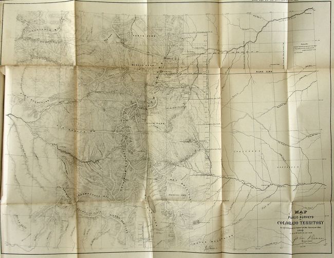
Map of Public Surveys in Colorado Territory. Presentation of topography and hydrology has improved considerably over the two earlier General Land Office maps although much of the territory remains to be surveyed. Location of Bend's Old and New Forts are noted. The ranges of the Cheyenne and Arapaho are noted to the east of Colorado City. An early map of the territory.
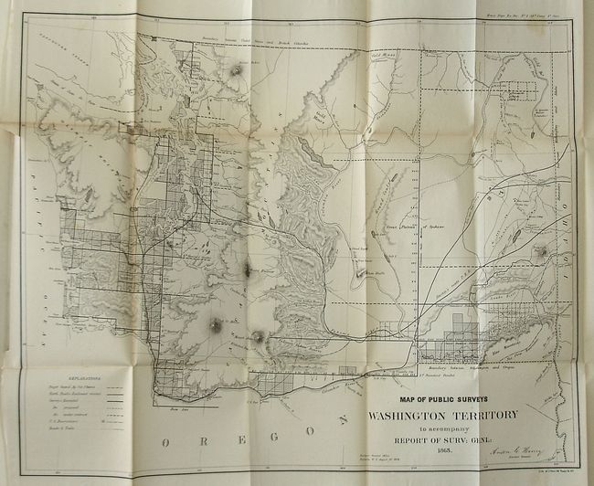
Map of Public Surveys Washington Territory... Remarkable detail for a map of this period with many place names, watershed detail, and hachured mountains. Steven's proposed railroad route is shown. Created by Anson G. Henry, the Survey General, in Olympia.
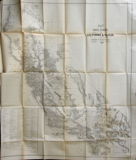
Map of Public Surveys in California & Nevada. A very detailed map of the state includes good detail of terrain and watershed through the use of hachures. But the main feature of this map is the large table, "List of Private Grants finally surveyed" that lists the names and keys to 433 grants on the map.
Sketch of the Public Surveys in the State of Minnesota. The northern half of the state is mostly blank with some surveying work along the shore of Lake Superior.
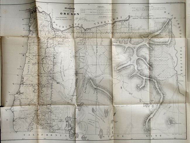
A Diagram of Public Surveys in Oregon. Attractive map showing very good detail. Most development is still west of the Willamette Meridian.
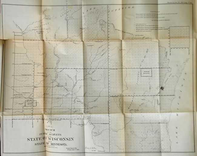
Sketch of the Public Surveys in the State of Wisconsin and State of Minnesota. Shows several Indian reservations, lakes, rivers, forts, and a list of notes on the surveying status of each township.
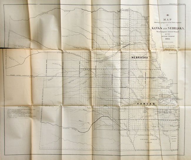
Map Showing the Progress of the Public Surveys in Kansas and Nebraska.... Shows Kansas and Nebraska to their current western boundaries. Numerous trust lands, and Indian reserves including Pawnee, Ottoe, Sac and Fox, and Omaha. Cherokee neutral lands and Osage lands are located at the bottom of the map. This map has a fold separation and an extraneous crease.
737 pages. Complete. 8vo. Rebound in blue cloth covered boards with printed title on spine.
References:
Condition: B+
Maps are generally good to very good with some light offsetting, occasional foxing and a few have fold separations reaching into the image. Text pages with minimal foxing. Covers, spine and binding as new. A library withdrawal stamp is located on the title page.