Catalog Archive
Auction 122, Lot 819

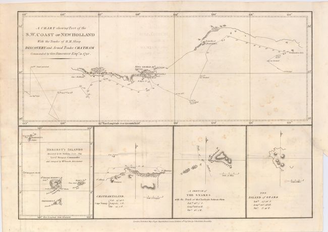
"A Chart Showing Part of the S. W. Coast of New Holland with the Tracks of His Majesty's Sloop Discovery and Armed Tender Chatham Commanded by George Vancouver Esq. in the Year 1791", Vancouver, George (Capt)

Subject: Australia

Period: 1801 (dated)

Publication:

Color: Black & White

Size:
15 x 10.5 inches
38.1 x 26.7 cm
Download High Resolution Image
(or just click on image to launch the Zoom viewer)

This crisply engraved chart shows the tracks of Captain Vancouver in his explorations along the coast of Australia in 179. Below the main chart are are four small maps of Hergest Islands (Marquesas), Chatham Islands (New Zealand), The Snares, and Opara Island (Rapo). Second edition published by J. Stockdale.

References:

Condition: B+

A nice impression on a sheet issued folding, now flattened. There is some scattered foxing in the map, and a repaired binding tear at right that enters the map about 1".

Estimate: $130 - $160

Sold for: $120

Closed on 12/5/2007

Archived