Subject: North Pacific Ocean
Period: 1785 (published)
Publication:
Color: Black & White
Size:
26 x 15.2 inches
66 x 38.6 cm
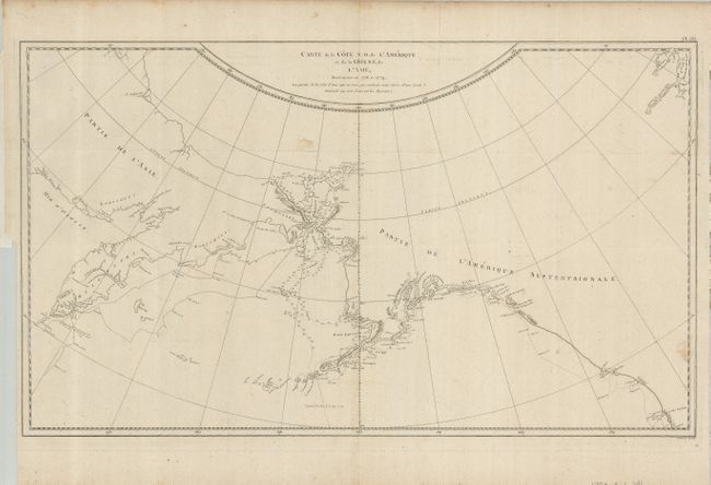
This large map is centered on the Bering Strait with soundings and dates that chart Cook's third voyage up the northern reach of the Pacific in his search for a Northwest Passage. Cook probed along the Oregon coast in bad weather to Nootka Sound, where he rested and refitted his ships. They sailed forth to the Alaskan and Chukotskiy peninsulas and from there into the Bering Strait. Cook reached 70° 41’ N before being forced back by the pack ice off Icy Cape. The expedition turned south down the Russian coast and then east to Norton Sound. Cook's journey then ended in Hawaii where Cook was killed in a dispute with the natives. From the first French edition.
References:
Condition: B+
Folding, as issued. Delicate impression on thick hand laid paper with original margins. There are a couple of minor light spots in map. The binding trim runs along the platemark at lower left leaving adequate margin for framing.