Subject: Western Hemisphere
Period: 1630 (published)
Publication: Nieuwe Wereldt ofte Beschrijvinghe van West-Indien…
Color: Hand Color
Size:
14 x 10.9 inches
35.6 x 27.7 cm
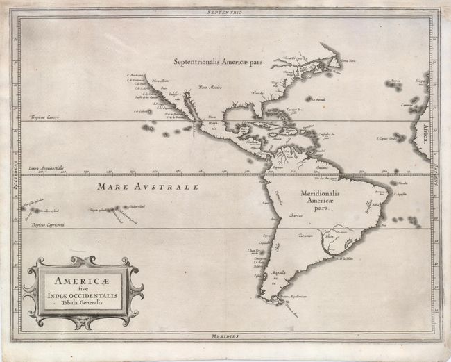
According to Burden this simple map is arguably the finest description of the Americas published in the seventeenth century. It was a collaborative effort between Hessel Gerritsz, the official cartographer to the Dutch East India Company and Johannes de Laet, the director of the newly formed Dutch West India Company. Together they had access to the latest geographical knowledge. Although Gerritsz had access to maps showing the insular form of California, he relies on more trustworthy accounts, such as Herrera, and depicts a peninsular form and thus the best west coast delineation to date. Rather than showing the controversial Northwest Passage, he truncates the map short of these latitudes. The map is decorated with a simple strapwork title cartouche.
References: Burden #229; Wagner #309.
Condition: B+
A nice impression on a sheet with the top margin extended professionally by the leaf-casting method, and the neatline reinstated in facsimile.