Subject: Western Africa
Period: 1630 (circa)
Publication: Atlas Minor
Color: Black & White
Size:
9.8 x 7.3 inches
24.9 x 18.5 cm
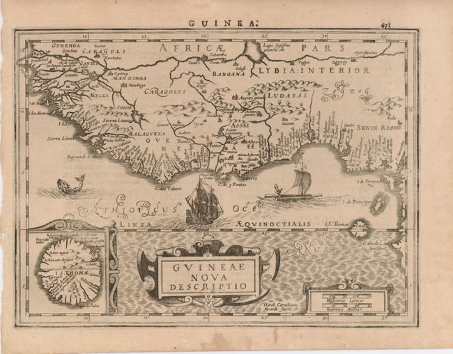
Reduced version of Mercator's superb map of western Africa covering from Senegal, Rio Senega, to Cape Lopez on the Gulf of Guinea just below the equator. The map reflects the Portuguese exploration and settlement in the region and includes a large inset of the island of St. Thomas. It is beautifully embellished with strapwork cartouches. The sea displays a sea monster, a Portuguese ship and native sailing boat. The map was engraved by Direk Cornelissen Swardt. Latin text on verso.
References:
Condition: B+
There is a faint stain in the lower part of the map, and near St. Thomas the impression is irregular.