Subject: Japan, Korea
Period: 1794 (dated)
Publication:
Color: Hand Color
Size:
24.8 x 18.5 inches
63 x 47 cm
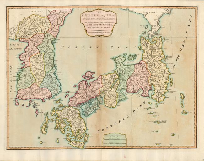
This large map of Japan and Korea was originally drawn by Robert Sayer for his General Atlas of 1790 and issued here by his successors, Robert Laurie and James Whittle. The map is based largely on the map of Robert de Vaugondy, but with many additional details from other sources, including the Portuguese and Kaempfer/Scheuchzer. Sayer revised many of the coastlines, often coming close to reality considering the inadequate information of the period. The land of Jeso Gasima (Hokkaido) is noted above Japan, with many towns noted along its coastline. A small island off the eastern coast is named Fatisio, or Unhappy Island the Place of Exile for the Japanese Grandees. The map is decorated with simple title and distance scale cartouches.
References: Walter # 87 & OAG-126.
Condition: B
A sturdy sheet with original color, toned throughout but darker on the centerfold.