Catalog Archive
Auction 122, Lot 718

"Kaart van Jerusalem en Omliggende Landstreck naar de Grondtekening van R. Pocke", Willemsz, Johannes Wessing

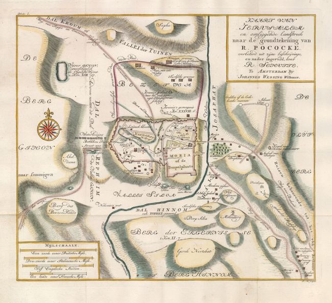
Subject: Holy Land, Jerusalem

Period: 1750 (circa)

Publication:

Color: Hand Color

Size:
12.2 x 10.8 inches
31 x 27.4 cm
Download High Resolution Image
(or just click on image to launch the Zoom viewer)

This scarce map is based on Richard Pococke's "A plan of Jerusalem and the Adjacent Country" that was originally drawn and engraved by Thomas Jefferys. This Dutch version is more focused on the city, leaving off a bit of the surrounding countryside. It shows both the ancient and modern city within walls. The roads to Jaffa, Bethlehem and Jerico are depicted. Richard Pococke was an ardent traveler who visited the Middle East in 1737-38. He published an account of his travels, "A Description of the East," in 1743-45. His map was one of the first scientific maps of Jerusalem based on first hand observation.

References:

Condition: A+

Issued folding, now pressed.

Estimate: $275 - $350

Sold for: $200

Closed on 12/5/2007

Archived