Subject: Belgium
Period: 1720 (circa)
Publication: Les Forces de l'Europe
Color: Hand Color
Size:
9.5 x 7.5 inches
24.1 x 19.1 cm
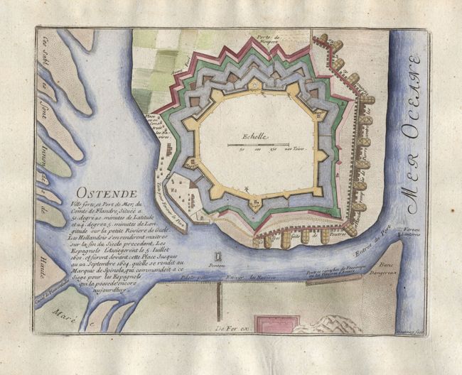
Nicolas de Fer held the title of geographer at Louis XIV's court. He was one of the most prolific publishers of plans of European cities in the late seventeenth century. The fortifications plans in Les Forces de l'Europe were designed to teach fortification techniques. Engraved by Van Loon and Schoonebeek after French engineers under the command of Vauban, the renowned military architect. The illustrations often include a description and a legend with the principal buildings; each city plan includes both fortifications and street layout.
Intriguing plan of the fort in the port city of Ostende as it was before the siege by the Marquis Ambrogio Spinola in 1604. The city was taken by him for Spain after the siege, which lasted three years and nearly destroyed the entire city.
References: Pollak #21, p. 40.
Condition: A
Delicate, later color with some show through on the verso.