Subject: North Pole
Period: 1638 (circa)
Publication: Gerardi Mercatoris Et I. Hondii Atlas…
Color: Hand Color
Size:
19.5 x 17 inches
49.5 x 43.2 cm
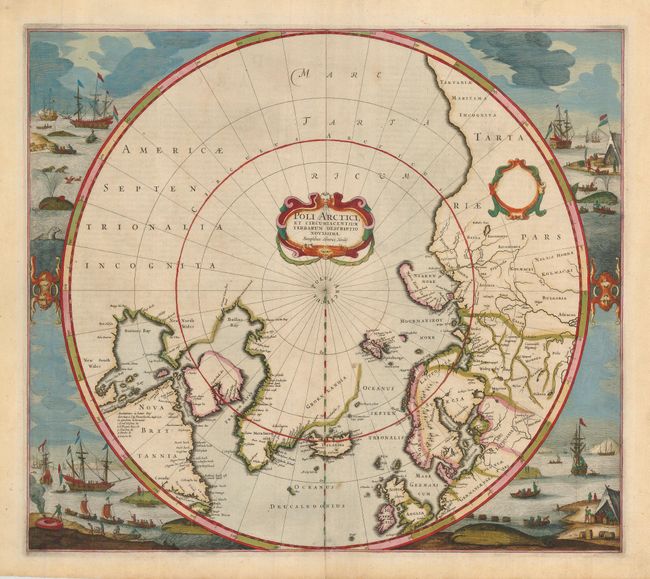
Hondius' important map of the polar region is one of the most decorative maps of the North Pole. It replaced Mercator's map in the Mercator/Hondius atlases in 1636, and incorporated much of the knowledge gained by the English in their search for a Northwest Passage to Asia. The cartography is based on Henry Briggs' depiction of Hudson Bay, showing a pair of bays in the bottom of Hudson Bay named Iames his Bay and The Great Bay of God's Deliverance. There are more names based on Hudson's explorations, including the note of Ne Ultra in an inlet at the top of the bay indicating that they could go no further there. There are several Dutch names in Labrador, many appearing for the first time on this map. The fascinating whaling scenes that surround the map also depict Dutch activity in the region. There are many types of ship and boats shown, as well as whales, seals and cormorants. Burden's third state (Kershaw's second state); the first with the whaling scenes. Latin text on verso.
References: Burden #246; Kershaw #99b.
Condition: A
Fine impression and original color on lightly toned paper with wide original margins. There is one insignificant spot in the map, still near fine.