Subject: Europe and Atlantic
Period: 1644 (published)
Publication: Lichtende Columne ofte Zee Spiegel
Color: Hand Color
Size:
21.5 x 17 inches
54.6 x 43.2 cm
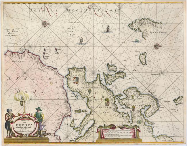
This extremely rare and handsome sea chart of Europe and the eastern Atlantic extends to include the Africa coast to Cape Verde and nearly all of Greenland. The unusual orientation has north to the right of the chart. It is richly embellished with rhumb lines, compass roses, coats of arms, sailing ships, distance scale, and a fine title cartouche. Theunis or Anthonie Jacobsz, was the founder of a flourishing printing and publishing house in Amsterdam. This map, and several others, were copied by Pieter Goos, which are more commonly seen on the market. This example has not been recorded for sale in twenty years of price records.
References:
Condition: A
Fine sharp impression. Expert, professional repair of a short fold separation at bottom and the rough bottom paper edge.