Subject: Atlantic Ocean, Canary Islands
Period: 1752 (circa)
Publication:
Color: Black & White
A nice lot of maps and views of Tenerife
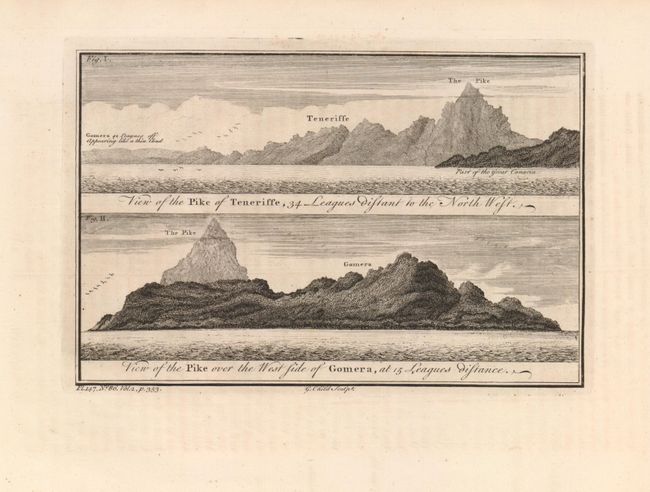
1) View of the Pike of Teneriffe, 34 Leagues Distant to the North West. / View of the Pike over the West Side of Gomera, at 15 Leagues Distance. Two views on one sheet, engraved by G. Child, circa 1750 (8.8 x 5.8").
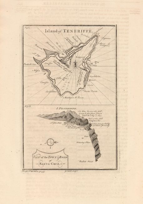
2) Island of Teneriffe. / View of the Town & Road of Santa Cruz on one sheet, engraved by G. Child, circa 1750 (5.7 x 8.8")
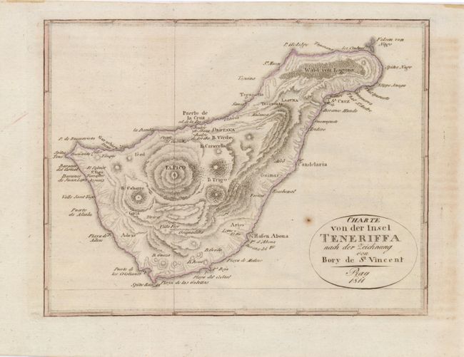
3) Charte von der Insel Teneriffa nach der Zeichnung von Bory de St. Vincent,Published in Prague, dated 1811. A lovely small map shows the dramatic topography; with faint hand color.(8.3 x 6.3")
References:
Condition: A
All with very good impressions, map 3 with a small rust spot.