Subject: Atlantic Ocean
Period: 1666 (published)
Publication: De Zee Atlas ofte Water Weereld…
Color: Hand Color
Size:
21.3 x 17.5 inches
54.1 x 44.5 cm
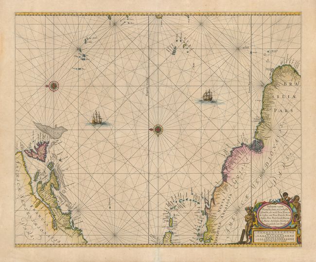
This is the first edition of this scarce sea chart. It covers the central Atlantic and extends to include the Maritime Provinces, Antilles and the northwest coast of South America, east to the Azores, Cape Verde, Madeira and the Canary Islands. A pair of compass roses orient the map with north to the left, and rhumb lines cross the map. While covering the same area as Theunis Jacobsz' chart of circa 1650, Goos based his map on the cartography of Joannes van Loon. Native figures adorn the decorative cartouche with three distance scales.
References: Burden #390.
Condition: B+
A dark impression on a sheet of thick paper with a minor printer's smudge and a few pinholes. The centerfold is reinforced on the verso with tissue, with a minor separation visible at the bottom. The generous margins have a couple of short tears.