Subject: Suriname and Guyana
Period: 1764 (circa)
Publication: Le Petit Atlas Maritime
Color: Hand Color
Size:
6.5 x 8.3 inches
16.5 x 21.1 cm
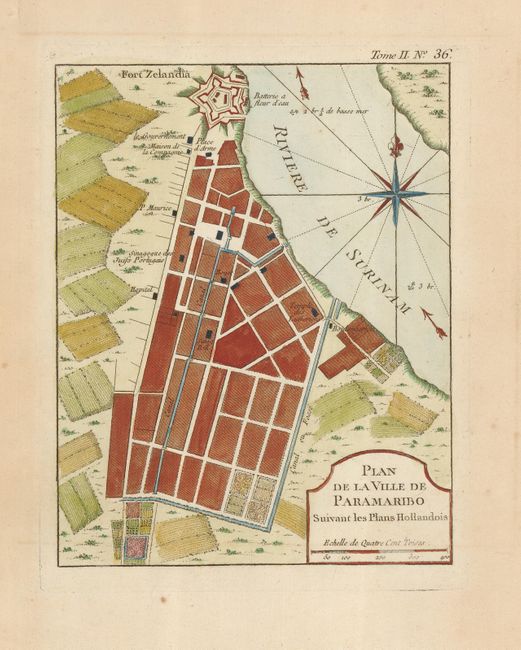
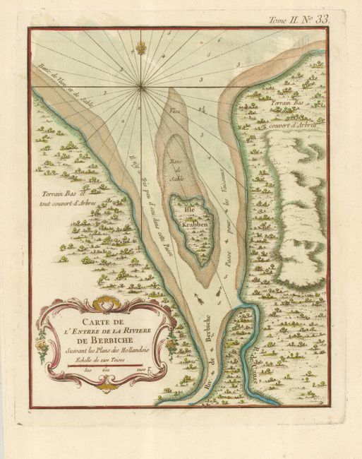
Lovely pair of maps detailing two areas colonized by the Dutch in South America.
1) Plan de la Ville de Paramaribo Suivant les Plans Hollandois is a plan of Paramaribo in Suriname, noting the Fort Zelandia at the mouth of the Suriname River, and important buildings such as the churches, government buildings, and the butcher. The surrounding countryside is a patchwork of cultivated fields, and the river notes soundings and current flow. A large compass rose orients the map.
2) Carte de l'Entree de la Riviere de Berbiche delineates the entrance of the Berbice River and Crab Island in Guyana. The soundings and navigational hazards are noted. The map is decorated with a simple rococo cartouche and a fleur-de-lys compass.
References:
Condition: A
Both nice impressions with wide original margins. Paramaribo with one spot in the margin, not affecting the map.