Catalog Archive
Auction 122, Lot 407

"A Map of Terra Firma, Guiana and the Antilles Islands", Moll, Herman

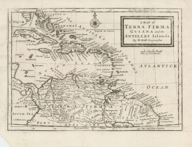
Subject: Northern South America and Lesser Antilles

Period: 1725 (circa)

Publication:

Color: Black & White

Size:
10 x 7 inches
25.4 x 17.8 cm
Download High Resolution Image
(or just click on image to launch the Zoom viewer)

A copper engraved map covering all of the West Indies and South America, north of the equator. In Guyana, the large, legendary Prime Lake is noted on the Equator, with the mythical city of gold, Manoa el el Dorado named upon its shores. Detail extends to show the Windward, Leeward, Caribbean and Bahaman Islands, Cuba and the tip of Florida ("Part of Louisiana"). A nice compass rose and title in block form complete the page.

References:

Condition: B+

A slightly uneven impression on a sheet with a couple of repaired tears in the upper margin, one just entering the map. Lower left corner is torn, well away from map.

Estimate: $200 - $275

Sold for: $140

Closed on 12/5/2007

Archived