Subject: South America
Period: 1860 (dated)
Publication: Geographie Commerciale et Industrielle
Color: Hand Color
Size:
33 x 23.5 inches
83.8 x 59.7 cm
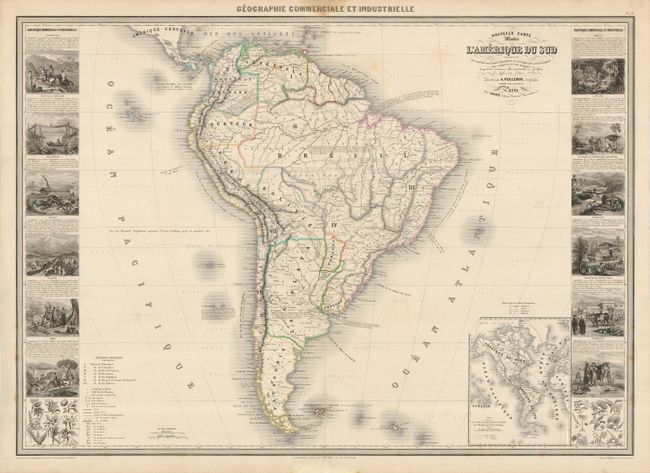
This magnificent large chart is from this scarce nineteenth century atlas. The map is filled with an impressive array of information illustrating the physical and geographical divisions, colonial possessions, roads and railways, forts, mines and the plant and mineral distributions. Includes an inset of the Western Hemisphere showing the primary shipping routes. The map is flanked with side panels containing numerous meticulously engraved vignettes representing the various industries and peoples of the different countries and regions.
References:
Condition: B+
Original outline color. There are a couple of light spots in the map and some damp stains in the blank margins, but it is overall very clean and attractive.