Catalog Archive
Auction 122, Lot 39

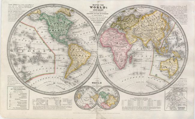
"Map of the World: and Chart Establishing the Size of Each Country, Nation or Kingdom its Population as a Whole and to a Square Mile also the Different States of Society Forms of Government Religion &c.", Burgess, Daniel

Subject: World

Period: 1839 (dated)

Publication:

Color: Hand Color

Size:
17.5 x 10.5 inches
44.5 x 26.7 cm
Download High Resolution Image
(or just click on image to launch the Zoom viewer)

A truly fascinating map of the world that includes a key at lower left with symbols denoting the 'state of society'. The symbols used are to denote whether or not a society is barbarous (bow & arrow), half civilized (plowshare), civilized (church) or enlightened (book). The key has additional symbols for various religions. Inset with a double polar projection and a map of Central Europe. The map includes many notes on population density, races, and types of government. The map is copyright dated 1839, but the U.S. Exploring Expedition (1838-1842) is shown on the map.

References:

Condition: B+

A nice example with a repaired centerfold. Margins with some minor creases and one chip.

Estimate: $110 - $150

Sold for: $180

Closed on 12/5/2007

Archived