Catalog Archive
Auction 122, Lot 388
"Isle de la Guadeloupe Scituee a 16 Degree de Lat. Septentrionale", Sanson/Mariette
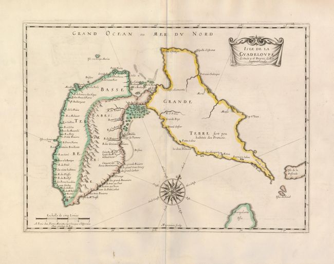
Subject: Guadeloupe
Period: 1650 (circa)
Publication:
Color: Hand Color
Size:
16.8 x 12.2 inches
42.7 x 31 cm
Download High Resolution Image
(or just click on image to launch the Zoom viewer)
(or just click on image to launch the Zoom viewer)