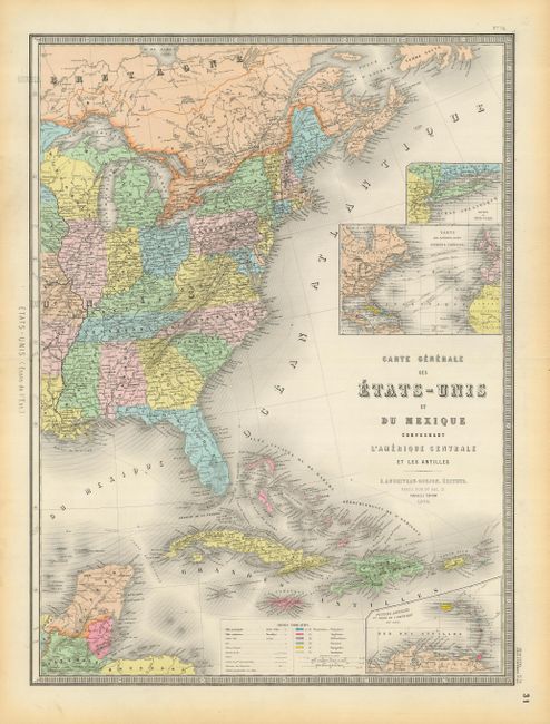
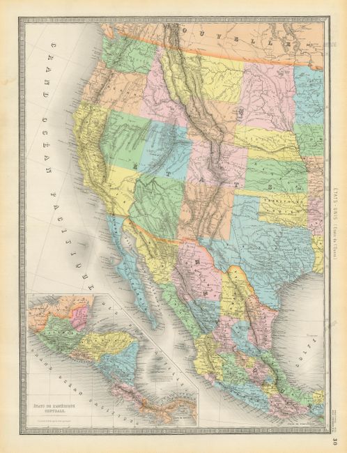
Subject: United States & Mexico
Period: 1870 (dated)
Publication:
Color: Hand Color
Size:
18.2 x 24.5 inches
46.2 x 62.2 cm
Attractive 19th century map of the United States, Mexico and the West Indies with insets of Central America, Lesser Antilles, New York, Atlantic travel and cable routes, and Long Island. It features a truly unusual configuration of California. The western boundary of California follows the Sierra Nevadas and then extends to include the southern portion of present-day Nevada, which contains Las Vegas named as Vegas de Quintana. The large Dacotah territory is shown before it was divided in 1889, and Oklahoma is named as Territoire Indien. The overland routes to Santa Fe, Mexico and California are shown as well as notations of native tribes and topography. A color key at bottom identifies the colonial possessions. The map is printed on two sheets; the size shown is for each sheet, if joined it would be 36" x 24.
References:
Condition: B+
Light marginal toning and some short fold separations, repaired on verso with archival tape.