Subject: United States, Texas & Mexico
Period: 1839 (dated)
Publication: Smith's Geography for Schools
Color: Hand Color
Size:
17.4 x 10.3 inches
44.2 x 26.2 cm
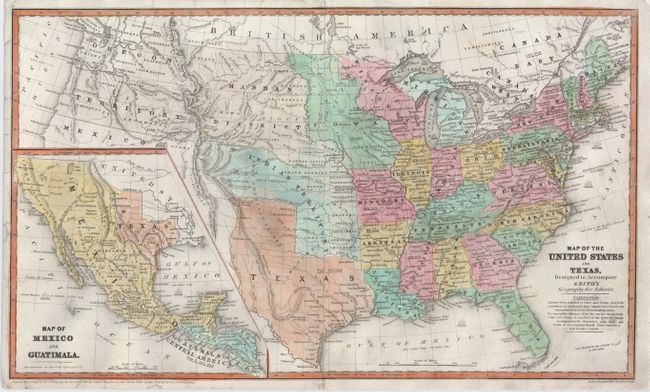
This great school atlas map with early territorial borders in the West features the Independent Republic of Texas with Austin shown as the capital by a large star. The Oregon Territory covers the northwest and extends well into Canada. The huge Indian Territory lies north of Texas and extends to the Mandan District, which in turn goes to the border with Canada. Iowa Territory is in a rare configuration, stretching from Missouri to the Canadian border and bounded east and west by the Mississippi and Missouri Rivers. The population is annotated for the states and Texas. The large inset at lower left is a detailed "Map of Mexico and Guatemala" and also shows the Republic of Texas, and the Spanish holdings in North America. Published by Daniel Burgess.
References:
Condition: B+
Professionally backed with tissue to reinforce some minor tears at the edges of the map and along the centerfold.