Subject: Southwestern United States and Mexico
Period: 1683 (published)
Publication: L'Amerique en plusieurs cartes
Color: Hand Color
Size:
9.1 x 7.7 inches
23.1 x 19.6 cm
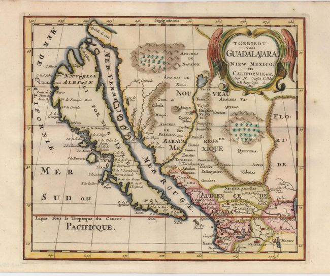
This is the Dutch version of the first regional map focusing on the island of California. This map was first published in 1657 and introduced the so-called second Sanson model of California. This depiction shows a small peninsula (Agubela de Cato) above the island, two bays along the island's northern coast and two new place names, Tolaago and R. de Estiete. Sanson actually based this information on the less well known map by Luke Foxe, but it was Sanson's map that influenced many other cartographers throughout the rest of the century. On this version the name Nouvelle Albion appears in the northern part of California. On the mainland there are new Indian tribes identified in the region of the R. del Norte, flowing southwest from a large inland lake and two large clusters of mountains are shown pictorially around tree filled valleys. A Lago del Oro is named on the coast. The map is decorated with a striking winged cartouche.
References: cf Burden #327; McLaughlin #16, state 5; Tooley (Amer) p. 116, #15.
Condition: A+
Tiny spot in blank margin, still very fine with a sharp impression.