Subject: Virginia, Civil War
Period: 1862 (dated)
Publication: Pope's Report to the Committee on the Conduct of the War
Color: Black & White
A fascinating set of Civil War battle maps produced by Maj. Gen. John Pope for his contribution to the 1863 report to Congress's Joint Committee of the War Department. The set of six includes:
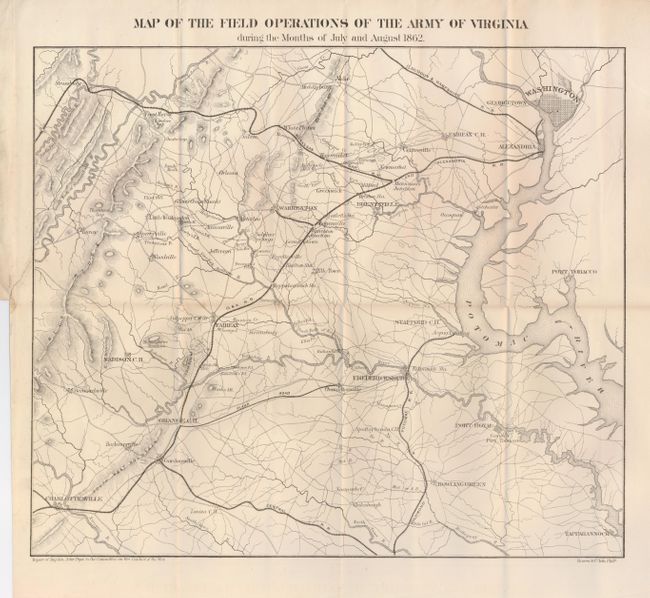
1) Map of the Field Operations of the Army of Virginia During the Months of July and August 1862 (16.5 x 14.3"). The largest map in the set, it shows the area from Charlottesville to Washington DC. Binding tear in left margin repaired with archival tape on verso. Grade A.
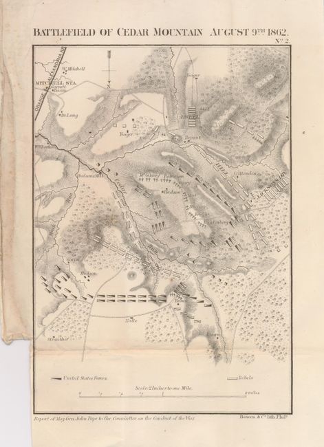
2) Battlefield of Cedar Mountain August 9th 1862 (6.1 x 8.8"). Shows the positions of Ewell, Hill and Jackson's Division. Some minor soiling in margin and a small spot in map. Grade B+.
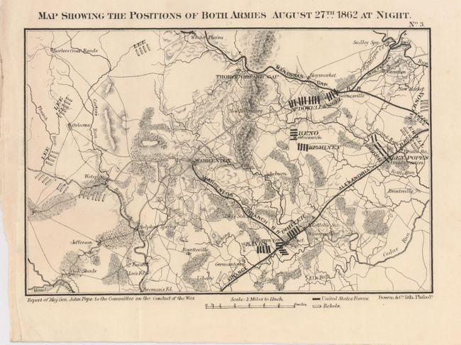
3) Map Showing the Positions of Both Armies August 27th 1862 at Night (9 x 5.8"). Locates Gen. Pope's Headquarters and the position of Gen. Lee's troops. Clean example with a minor extraneous crease. Grade A.
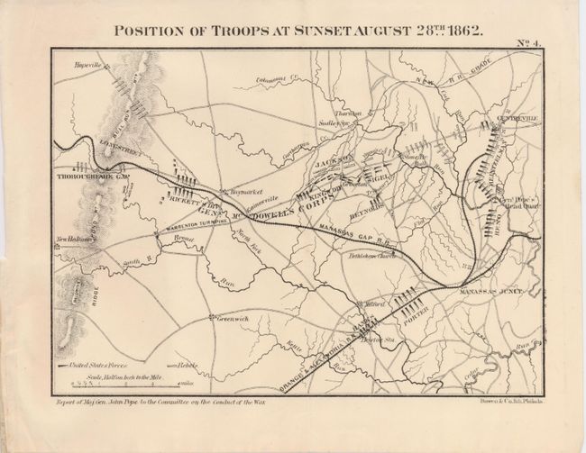
4) Position of Troops at Sunset August 28th 1862 (8.8 x 6.2"). Shows the tremendous troop movement from the previous day shown in map #3. Grade A+.
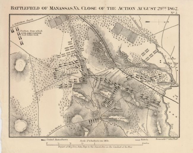
5) Battle of Manassas, Va. Close of the Action August 29th 1862 (8.8 x 6.3"). Good topographical detail with forests, creeks and some farmland. Grade A+.
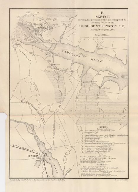
6) E. Sketch Showing the Position of the Attacking and Defending Forces at the Siege of Washington, N.C., March 29 to April 16, 1863. (8.3 x 11.7"). This map has a key identifying 24 numbered features on the map, mainly gun positions and descriptions. Grade A+.
References: Stephenson (CW) 465.67; 573.5; 573.6; 573.7; 526.5.
Condition:
See individual descriptions.