Subject: Virginia
Period: 1824 (circa)
Publication: A New General Atlas, Comprising a Complete Set of Maps…
Color: Hand Color
Size:
11.2 x 8.5 inches
28.4 x 21.6 cm
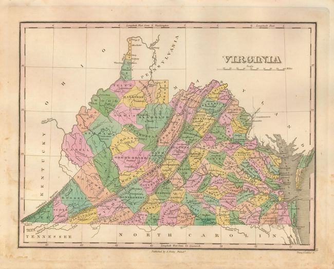
This handsome map of the state details the county seats, roads, towns and settlements, and watershed. The development is primarily east of the Allegheny Mountains, but the entire state (which now inlcudes today's West Virginia) is divided by county with county seats assigned to all. County orientation suggests the map is up to date to 1822: Allegany has just formed from Bath and Pocahontas is present, but the major county changes of 1824 are not shown. Engraved by Young & Delleker. According to Ristow, Finley published his atlases between 1824 to 1834, with separate issues published in the years 1824, 26, 29, 30, 31, 33 and 1834.
References:
Condition: B+
Very nice original color and fine impression on thick paper with full margins. Some marginal foxing that just enters the map at left edge.