Subject: Texas
Period: 1879 (dated)
Publication: General Atlas
Color: Hand Color
Size:
21.3 x 14 inches
54.1 x 35.6 cm
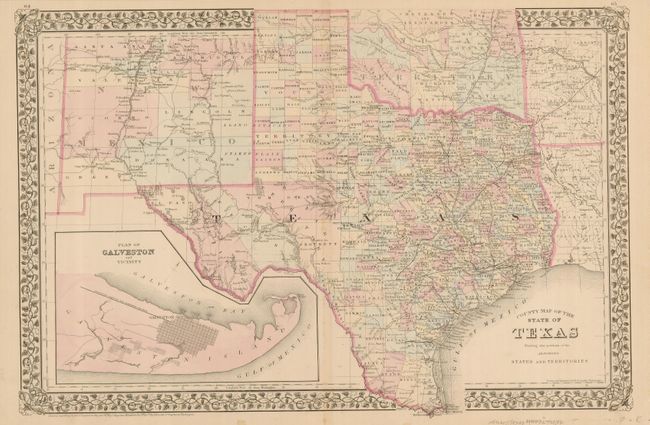
An attractive, double-page map of Texas extending to include parts of New Mexico, Oklahoma, Arkansas and Louisiana. The map presents an excellent view of the county development with only the large regions of West Texas yet to be organized. Galveston’s role as a main port of entry is obvious as it is depicted in a large inset. The Llano Estacado, or Staked Plain, is shown extending from the New Mexico Territory through the Texas Panhandle. Numerous railroads serve the southeastern part of the state. Indian Territory is divided into several large nations and reservations. The map is surrounded in Mitchell's distinctive grapevine border. Drawn and engraved in Philadelphia by W. H. Gamble.
References:
Condition: B+
A nice example with slightly faded original color and some minor toning on the centerfold. A couple of minor spots in the lower margin, not affecting the map.