Subject: Texas
Period: 1860 (dated)
Publication: New General Atlas
Color: Hand Color
Size:
13.5 x 10.7 inches
34.3 x 27.2 cm
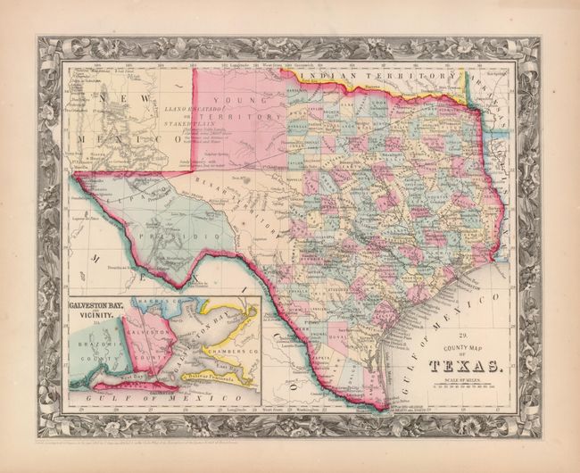
One of the most attractive maps of the state of Texas, inset with a map of Galveston Bay and Vicinity. West Texas is made up of Young Territory, Bexar Territory, El Paso and Presidio Counties, and clearly shows the Llano Estacado or Staked Plain with a notation about the region being "destitute of both wood and water." Trails and roads are shown and limited railroads extend only into Austin. Numerous dashed lines indicate proposed railroads. The map is surrounded by the finely engraved border seen with the 1860 issues of this map.
References:
Condition: A+
Lovely original color on a sheet with a couple of tiny rust spots.