Subject: Texas
Period: 1853 (dated)
Publication:
Color: Black & White
Size:
17 x 15 inches
43.2 x 38.1 cm
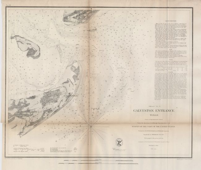
This coastal survey chart details the entrance to Galveston Bay. It includes a town plan of Galveston without streets named. The chart extends to Pelican Island, Bird Key, and Bolivar Point. It locates buoys, a beacon, a light boat, and is filled with soundings, bottom types, extensive notations on sailing directions, tides, etc. Triangulations were accomplished in 1848 by R.H. Fauntleroy and J.S. Williams, the topography was accomplished in 1849 and 1850 by J.M. Wampler, while the hydrography was under the direction of T. A. Craven and A. S. Baldwin in 1851 and 1852.
References:
Condition: B
There is toning along folds and several fold intersections have been repaired with archival tape on verso.