Catalog Archive
Auction 122, Lot 33

"Algemeene Waereldkaart, volgens het Ontwerp van Mercator…", Bonne/Bachiene
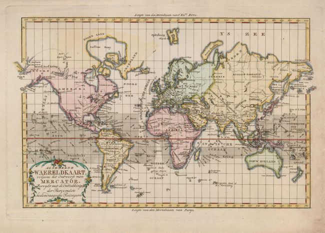
Subject: World

Period: 1785 (circa)

Publication:

Color: Hand Color

Size:
12.5 x 8.2 inches
31.8 x 20.8 cm
Download High Resolution Image
(or just click on image to launch the Zoom viewer)

This handsome copper engraved world map on Mercator's projection shows the new discoveries of the latter part of the eighteenth century. Alaska is shown in a rudimentary shape with dotted lines for much of its coastline. Australia and New Zealand are fully formed, but Tasmania is still shown to be attached to the mainland. Numerous small islands are shown throughout the world, including Cook's discoveries in the Hawaiian Islands. The ocean currents are shown with directional arrows. The map is decorated with a nice title cartouche.

References:

Condition: A

Minor toning in blank margins, else fine.

Estimate: $160 - $200

Sold for: $250

Closed on 12/5/2007

Archived