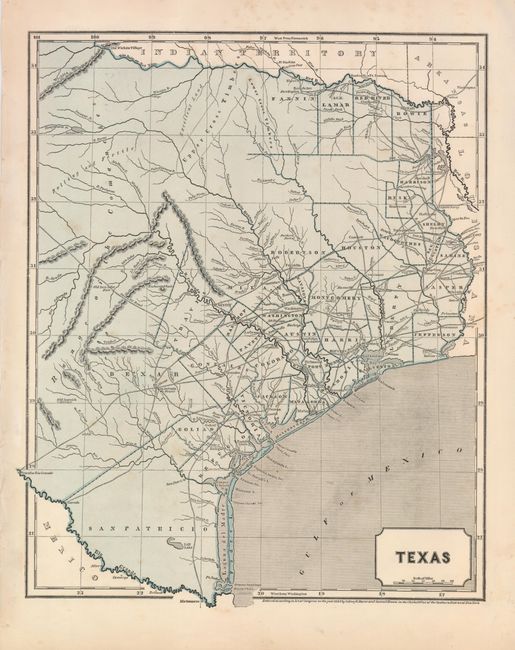
Subject: Texas
Period: 1844 (dated)
Publication:
Color: Printed Color
Size:
12 x 15 inches
30.5 x 38.1 cm
This scarce, desirable Independent Republic of Texas map extends north to above the Red River to the Old Wichita Village, and west to the Presidio Rio Grande and the Rio Colorado at about 101° West. This map is an early example of the cerographic engraving process, and was originally issued as a loose supplement, later bound into Morse's American Atlas. The map locates early land grants, counties, towns and missions, wagon roads, watershed, forts, and many other details. Blank verso.
References: Day #110.
Condition: A
A little faint toning, still a nice example of this uncommon map.