Subject: Rhode Island
Period: 1824 (circa)
Publication: A New General Atlas, Comprising a Complete Set of Maps…
Color: Hand Color
Size:
8.5 x 11.2 inches
21.6 x 28.4 cm
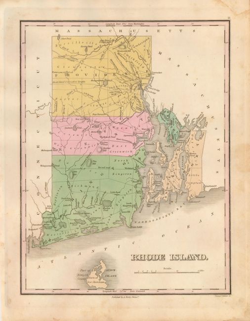
This copper engraved map shows the county seats, roads, towns and settlements, watershed, and coastal detail. It is filled with interesting features including several turnpikes; Chepachet, Norwich, Pawcatuck, Providence & Douglass, and the Rhode Island & Connecticut. Also locates Tift's Hill, Block Island, the Were Bridge, Ten rod road, numerous mills, and much more. Clearly shows the five counties of Providence, Kent, Washington, Worth, and Bristol. Engraved by Young & Delleker. According to Ristow, Finley published his atlases between 1824 to 1834, with separate issues published in the years 1824, 26, 29, 30, 31, 33 and 1834. A nice example.
References:
Condition: B+
Very nice original color and fine impression on thick paper with full margins. Some marginal foxing with just a trace in map.