Subject: Pennsylvania, Philadelphia
Period: 1764 (published)
Publication: Le Petit Atlas Maritime
Color: Black & White
Size:
6.5 x 8.5 inches
16.5 x 21.6 cm
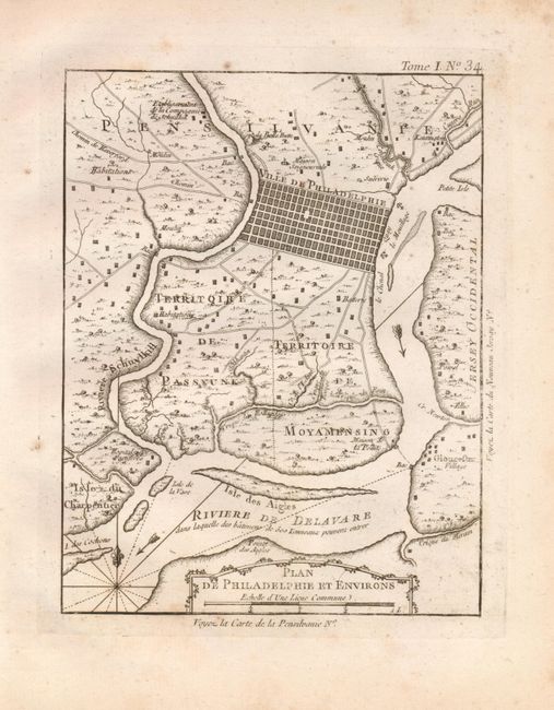
This is a copper engraved pre-Revolutionary plan of the city of Philadelphia and vicinity. The grid pattern of streets in Philadelphia is based on the Holmes plan, and the surrounding countryside and roads are derived from Scull and Heap's important map. Bellin narrowed the scope of this map to extend from just north of the city to just below Mud Island. The regions south of the city are labeled Territoire de Passyunk and Territoire de Moyamensing. It also shows the towns of Kensington, PA and Gloucester, NJ, mills, ferries, and anchorages in the Delaware River. On Province Island the Hopital des Pestiferes (immigrant quarantine known as a pesthouse) is located. Rhumblines and fleur-de-lys in the Delaware River.
References: Phillips (A) #3508 Vol. 1 #34; Sellers & van Ee #1309.
Condition: B+
On thick hand laid paper with wide margins and watermark. Some scattered marginal foxing with a few light spots in map image.