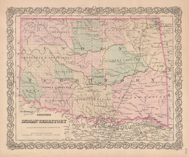
Subject: Oklahoma
Period: 1876 (dated)
Publication: General Atlas
Color: Hand Color
Size:
15.5 x 12.8 inches
39.4 x 32.5 cm
A most interesting and detailed map that reflects the status of lands allocated to various tribes. In 1817 the U.S. government began to relocate the principal eastern Indian tribes from their traditional home lands to Indian Territory where the Five Civilized Tribes formed the nucleus of an organized government. By 1876 there were more that twenty-five tribes settled on lands once promised to the original five. This map does not include the panhandle, which by this time are in Public Lands. The attractive map is surrounded by Colton's signature strapwork border. Unrelated text on verso.
References:
Condition: B+
An example with fine, original hand coloring. There are a couple of repaired tears that just enter the border, and a couple in the margins.