Catalog Archive
Auction 122, Lot 307
"A Plan of the Country from Frogs Point to Croton River Shewing the Positions of the American and British Armies from the 12th of October 1776 until the Engagement on the White Plains on the 28th", Lewis, Samuel
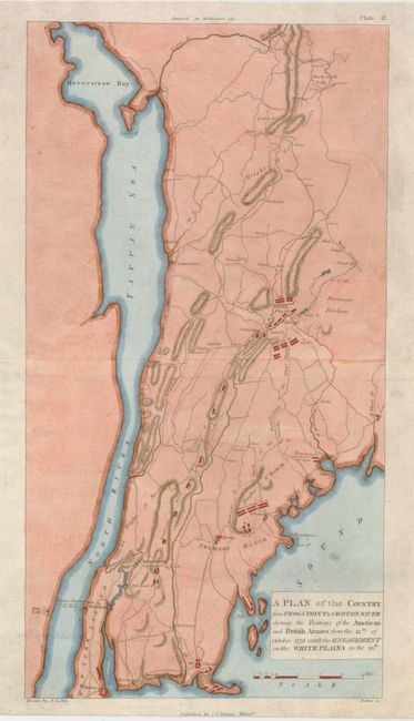
Subject: Revolutionary War, New York
Period: 1807 (circa)
Publication: Marshall's Life of Washington
Color: Hand Color
Size:
8.5 x 16 inches
21.6 x 40.6 cm
Download High Resolution Image
(or just click on image to launch the Zoom viewer)
(or just click on image to launch the Zoom viewer)