Subject: Massachusetts, Boston
Period: 1914 (dated)
Publication:
Color: Printed Color
Size:
19 x 14 inches
48.3 x 35.6 cm
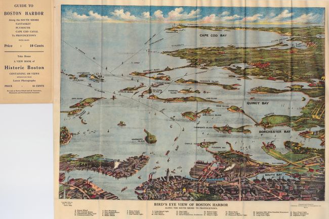
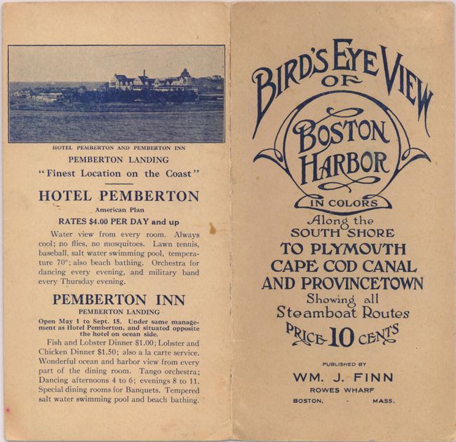
Nice bird's-eye map produced for the tourist trade. The attractively colored map folds into paper covers with the title "Bird's Eye View of Boston Harbor in Colors Along the South Shore to Plymouth Cape Cod Canal and Provincetown Showing all Steamboat Routes. Price 10 cents." The birds-eye map extends from South Bay all the way to Cape Cod Bay and Provincetown. At the bottom is a numerical key naming and locating 25 landmarks and lighthouses. The map names East Boston, Dorchester Bay, Quincy Bay, Governor's Island, Peddock's Island, Deer Island, Nantasket Beach, Duxbury, Jerusalem, and much more. Numerous ferry and ship routes are shown. The map was printed by either the collotype or color gravure method by the Federal Engraving Co., Boston. Dated 1914, this is an earlier example than we've previously seen.
References:
Condition: A
Beautiful example that is fine less two very small fold intersection splits. Fine color and impression. Covers also near fine with just a hint of toning at edges. Apparently an unopened and unused example.