Subject: Massachusetts
Period: 1855 (dated)
Publication:
Color: Black & White
Size:
20.5 x 28 inches
52.1 x 71.1 cm
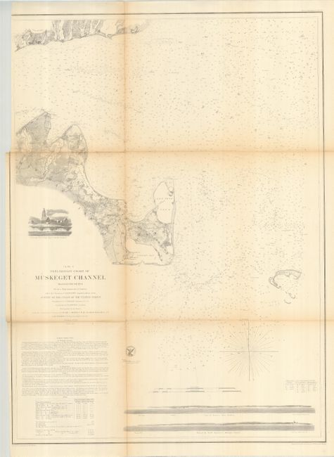
This is an early example of one of the best nineteenth century charts to show Martha’s Vineyard, Falmouth and the Nantucket Sound. Towns, villages, farms, and roads are all finely detailed along with hundreds of soundings, shoals and anchorages. At bottom are coastal approach views of Holmes’ Hole Harbor and the entrance to Muskeget Channel. Above the title is a finely rendered vignette showing the Cape Poge lighthouse. Engraved by F. Dankworth, E. Yeager, J.V.N. Throop and J. Young. With the seal of the Coast Survey and signed in the plate by H.W. Benham.
References:
Condition: B
Binding trim to neat line at upper left, as issued. Some light fold toning with weakness along one fold. Folding as issued.