Subject: Kentucky
Period: 1814 (circa)
Publication: American Pocket Atlas
Color: Black & White
Size:
7.5 x 6 inches
19.1 x 15.2 cm
Mathew Carey was a seminal figure in early American publishing; establishing the first publishing firm to specialize in cartography and issuing the first atlas devoted exclusively to American maps. He set up an elaborate cottage system of craftsmen for compiling, engraving, printing, and coloring maps. This practice was emulated by later American cartographic publishers such as John Melish and Henry S. Tanner. The American Atlas concept was also adopted by other publishers in both the United States and Europe.
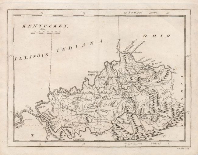
This is a copper engraved map that details towns and villages, watershed, topography, and wagon roads. It provides good detail of place names throughout the state. Longitude is shown from London and Philadelphia. Excellent detail of the road system distinguishes this small map.
References:
Condition: A
Folded, as issued with faint toning.