Subject: California
Period: 1849 (dated)
Publication: Senate Doc. 47, 31st Congress, 1st Sess.
Color: Black & White
Size:
19.5 x 21.3 inches
49.5 x 54.1 cm
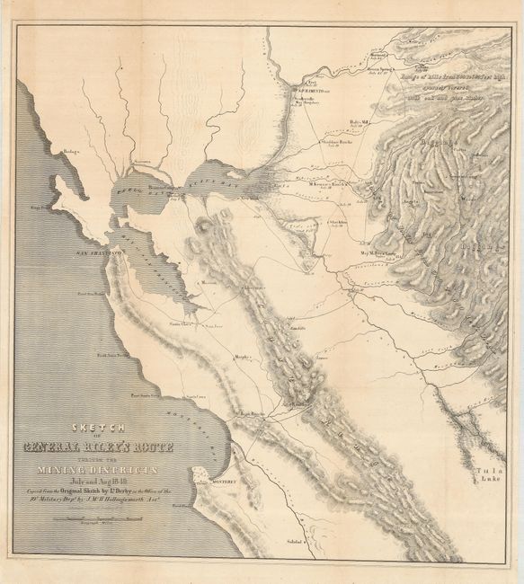
Important California Gold Rush map made from the original sketch by Lt. Derby in the office of the 10th Military Dept. It is historically important, not only for its depiction of Gen. Riley's route, but because it names, for the first time, certain actual mining camps in the middle Sierra foothills; Mormon Island (misspelled Mormont), Coloma (mislabeled Colluma), Curtis, Sullivan's, Corons, Jamestown, Woods and Sonora. The entire route of the Riley party is noted, with the dates of their visits to the various camps, and covers the region from Monterey Bay, north to Sacramento and east to the gold diggings.
References: Wheat (Gold) #79; Wagner-Camp-Becker 179 b: 1 & 2.
Condition: B+
A nice example issued folding, now flattened with the left binding side extended to facilitate framing. There are a few scattered rust spots, still a clean map. Some fold intersections have been reinforced with tissue on the verso.