Subject: Western United States
Period: 1851 (dated)
Publication: New Universal Atlas of the World
Color: Hand Color
Size:
12.7 x 15.5 inches
32.3 x 39.4 cm
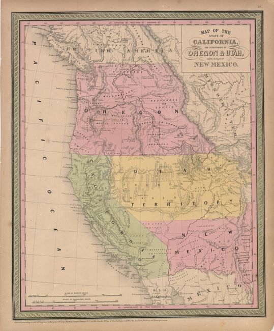
A great map of the western territories and the new state of California from this superb series of maps originated by Samuel A. Mitchell in 1846. Oregon Territory takes in all of present day Washington and Idaho. The huge Utah Territory (formed the previous year) covers the region labeled Fremont Basin, and stretches from the California border to just past the Rocky Mountains. New Mexico Territory (also formed in 1850) encompasses parts of present-day Colorado and Arizona and its southern boundary is on the Gila River -- pre Gadsden Purchase. The "Gold Region" is clearly marked along the Sacramento River and there is no county development shown in the new state.
References: Wheat (TMW) #725; Phillips (A) #805.
Condition: B+
An attractive example with nice original color. The sheet has some foxing, and the margins are toned with a couple of repaired short tears, not affecting the map.