Subject: Western United States
Period: 1850 (dated)
Publication:
Color: Black & White
Size:
17 x 13 inches
43.2 x 33 cm
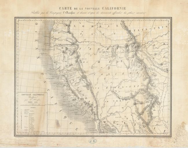
This very scarce California Gold Rush map covers most of the west with a post-Fremont depiction of the Great Basin. An interesting note shows the location of Capt. Sutter's mechanical sawmill on the American River, and the site of the initial discovery of gold that led to the Gold Rush. The path of those seeking their fortunes, the Route conduissant a New York suivie par les caravanes, runs from San Francisco eastward, past the Great Salt Lake, and beyond. This unusual map also shows the Route de Santa Fe between Los Angeles and Santa Fe. Arizona is shown as a town on a tributary of the Gila River, and a string of Spanish missions runs up the coastline from San Diego to San Fernando.
References: cf Wheat (Gold) 160 p.78
Condition: B
Map has some mildew in the margins, and toning throughout. Several small pinholes and some misfolds. Mapmaker's Initials stamped in lower margin.