Subject: Minnesota and Dakotas
Period: 1850 (dated)
Publication: Mitchell's New Universal Atlas
Color: Hand Color
Size:
16 x 13 inches
40.6 x 33 cm
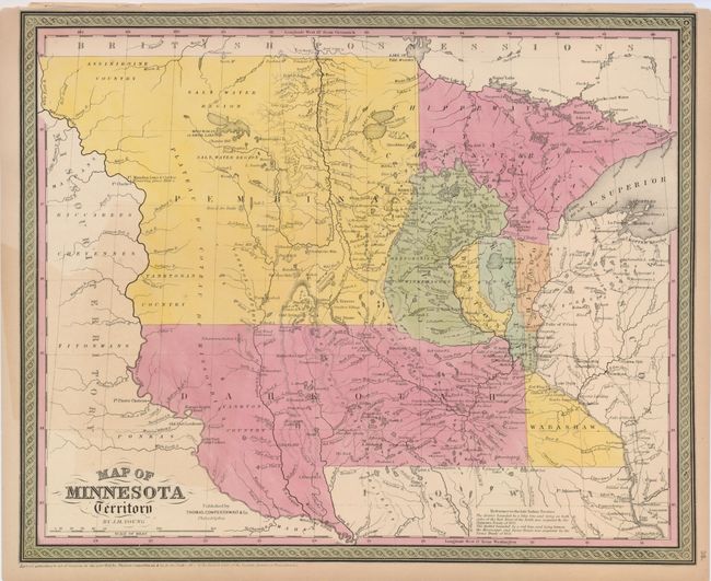
This well engraved map is an early example of Young's notable map. This edition has county development limited to the extreme southern and eastern portions of the territory that shows the map to be circa 1851. The large region in west is labeled Pembina, while the large southern area is Dakotah. Settlement is almost exclusively along the Mississippi River. Locates many Indian tribes including the Assiniboine, Yanktonan, Chippeway, Mennomonees, Winebagoes, etc. Forts along the Missouri River include aux Cedres, Lookout, Pierre Choteau, Clarke, and Mandan (noted as the wintering place of Lewis and Clarke in 1804-05). Fancy titling and decorative borders. A detailed and interesting map that documents the early stages of development of Minnesota and the Dakotas.
References:
Condition: B+
Very lovely original full coloring and crisp impression. A light area of toning at left in uncolored area. Short tear in upper margin just into border well closed on verso with archival tape.