Subject: Central United States
Period: 1812 (circa)
Publication:
Color: Hand Color
Size:
9.6 x 7.6 inches
24.4 x 19.3 cm
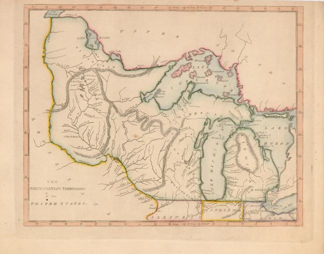
A scarce map covering the region from Michigan through Lake of the Woods and Lake Winnipeg. The Great Lakes are slightly distorted and include the spurious islands in Lake Superior including one named Phillipcaux I. The map names Michigan, Illinois, Indiana, Ohio, and the settlements of Detroit, Sandwich, Miami B., F. St. Claire, F. Dearborne, Chicago, and more. Illinois' northern border is here shown even with the top of Indiana at 42°, which places Chicago in the Northwestern Territory. Spurious mountain ranges are shown snaking across the territory and are engraved in hachure.
References:
Condition: A
There are a couple small, unobtrusive spots and an edge tear has been repaired with archival tape on verso.